Meet under the Eagle’s Nest
The information in this piece may be out of date. I have moved away from Cheyenne and am no longer maintaining this site. You may leave a comment if you wish. Useful comments will continue to be posted.
There are landscapes that create memories, spark conversation and connection, that stir reflection. Meeting places of water and rock often make for the meeting of kindred spirits. And they can be just plain fun.
One of these is Eagle’s Nest Open Space, just forty minutes’ drive to the southwest of Cheyenne, Wyoming.
More than one hundred years ago cowboys noticed eagles, big golden eagles, avian royalty with six to seven foot wingspans. The eagles nested on top of a tall rock wedge, blade to the sky. They called the rock “Eagle’s Nest.” Eagles still nest there today.
Here the North Fork of the Poudre River makes its run out of the grassy foothills. Surprised by the bulk of Eagle’s Nest blocking its path it makes an unlikely ninety degree turn into a wild jumble of rough country
The rock itself rises majestically, grey granite washed with lemon-lime lichen. It pronounces the end to the upheaval, a confusion of granite hills, knobs and mountains, mantled in brown mountain mahogany, that extend to the west. Inaccessible to ground-bound predators the rock is a safe aerie with a rich larder.
A picnic below the Eagle’s Nest on a warm spring day, tucked into the shade of the cottonwoods is, well it is about as good as it gets.
Trails
Eagle’s Nest Open Space at Livermore, Colorado, is one of Larimer County’s fine parks. A good access road leads to the trailhead, free maps, a sign board and toilets.
From the parking area a loop trail begins, connecting to a second loop trail, laid out like clip-on sunglasses. Where the “glasses” have a bridge there’s a bridge. The trails have been freshly made for fun, to guide you up, down and around, giving views of all the wonders: prairies, overlooks, the rock–of course–and even small eroded badland gullies.
The first loop and bridge, leading to the river and trees, is 3.4 miles round trip. The second loop with more views adds another 1.8 miles for the adventurous or for those kids with too much energy. The amount of up and down on these trails may make them seem a bit longer than they are.
Après Hike
For many the best part of a little adventure is the meal afterward. Is it the newly awakened taste buds? Or guilt free dining, replenishing those freshly burned calories?
That meal couldn’t be closer. Near the entrance is The Forks, a deli with fine toasted subs, hand scooped ice cream, old fashioned shakes and, upstairs a full bar with Easy Street Wheat and 90 Shilling Ale on tap.
You can enjoy your reward from the second floor deck—or the bar—and look out at the grand rock and the ground just explored. And these good folks would be happy to outfit your picnic, delicious food to carry and go.
Getting there
The park is near the junction of Hwy 287 and Red Feather Lakes Road at Livermore, Colorado. Take I-25 south from Cheyenne, exit at Owl Canyon and head west on CR 70. At the end of 70 turn right on CR 21 following the signs to Owl Canyon. At the end of 21 turn left on CR 72. At its end turn right on Hwy 287. After dropping through the road cut you’ll come to “The Forks”. Turn left on 74E toward Red Feather Lakes. Just past the Fire Station are signs directing you to the left, Eagle’s Nest Open Space. Follow that road to the parking area at its end.
Useful info
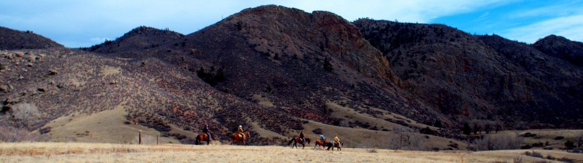
Entry is free. Dogs are allowed on leash. The area is a popular equestrian area with good parking for trailers. Mountain bikes are not allowed. Bring your drinking water as none is available. Hats and sunscreen may be advisable as you’ll find little shade. For maps and more see www.larimer.org/naturalresources/eagles_nest.cfm.
The trailhead is at 6’200 feet in altitude, the same as Cheyenne. Weather wise, what is happening here is likely happening there.
Along the way: The Owl Canyon Mystery
Note that as you come into Owl Canyon and make your turn on to Hwy 287 you are passing one the great botanical mysteries of our area. Among the junipers on the right are pinyon pines, the most northerly pinyons in North America. In fact the next grove is one hundred miles south, too far for the seeds to be carried by wind or animals.
So how did they get here? It is thought that the oldest trees sprouted from delicious pinyon nuts cached here by Native Americans 500 years ago. Inadvertently, or perhaps purposefully, they planted a grove which thrives in this micro-climate, providing a rich source of nuts.
Unfortunately, even though the land is a Colorado State Resource Area, no public access is allowed except along the highway shoulder. Most of the trees are hidden behind the high ridge near the rock quarry. Enjoy what views you can across the fence.

Comments
Mark Stella
Apr 17, 2014
Five or so miles of really pretty trails. Love the views.