Rainbow End, Medicine Bow National Forest, Laramie Range, WY
The information in this piece may be out of date. I have moved away from Cheyenne and am no longer maintaining this site. You may leave a comment if you wish. Useful comments will continue to be posted.
North Laramie River Trail
Highlights: A rather boring hike to a destination that truly has it all: scenery, wildlife, good stream fishing, a swimming hole and the interesting remains of the old Rainbow End, a lodge and string of cabins that was a popular resort for those seeking cool canyon solace and leaping rainbows from the 1920’s through the 1950’s. And you can come and stay for the price of a walk, 2 ½ miles each way. But bring a tent and your own cooking gear.
Location: About 20 miles west of Wheatland in the Laramie Range along the North Laramie River.
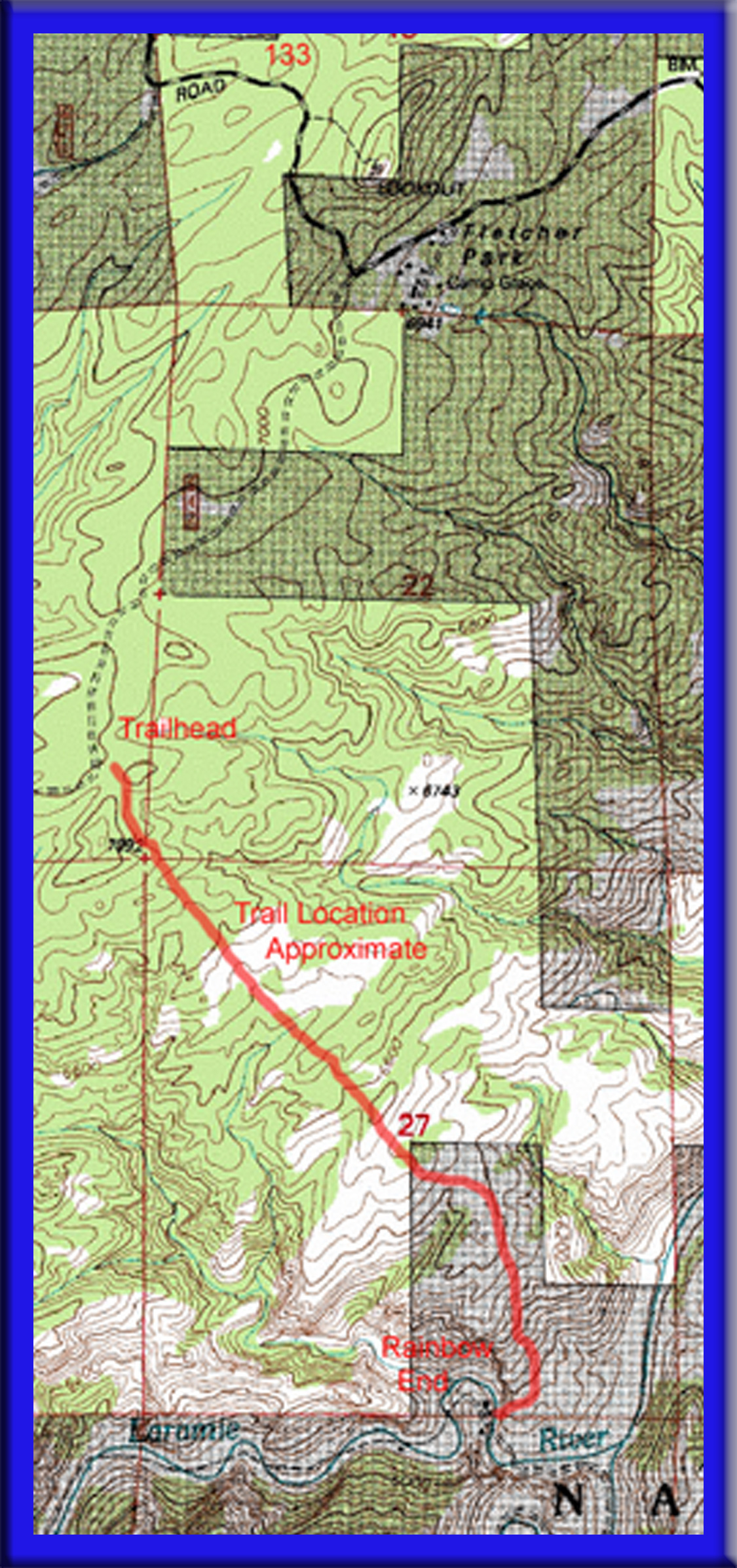
Elevations: Trailhead 6,980; Rainbow End 5,850′
Distance: 2 ½ miles each way
Maps: Medicine Bow National Forest, Laramie Peak Unit; USGS Fletcher Park Quad
Guide: Marc Smith’s Hiking Wyoming’s Medicine Bow National Forest, Douglas Ranger District pamphlet “North Laramie River Trail #625″
Trailhead: Take I-25 north from Cheyenne, past Wheatland to exit 94, El Rancho Road. Go west on CR 114, Fish Creek Rd. After 13.7 miles turn right on CR 113, Fletcher Park Rd. (AKA FS 716) and continue 5.5 miles. Just past Camp Grace, turn south on FS 642, Cow Camp Road. Look for a little spur on the left, FS 643, where you’ll find parking. The trailhead is marked as the “North Laramie River Trail”. The route is passenger car passable.
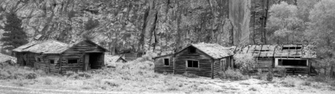
The Hike: The first mile is mostly level through the burned remains of ponderosa pine, the result of a lightening strike in 1996. New growth returns slowly in this dry land but the flowers can be beautiful and the deer are plentiful. The second mile is a steady descent that gets ever steeper as you go, leaving the blackened trees to switchback down an open hillside. The old inn, the lovely North Laramie River and the hay fields long left to flower await you. This flat bottom valley is held in a cradle of jagged rock walls and steep hillsides, sheltered like a little Shangri-la. More cabins, barns and workshops are found upstream. You’ll have to wade the river as it meanders back and forth to get to some of them.
If there is an ideal little backpack trip for tweens and teens, this is it. The fishing is good for rainbows and browns. Behind the main house the river opens to a pool which allows a cooling plunge. The meadows are full of flowers. And there are the cabins to explore.
The Bullock family homesteaded here in 1915. A hospitable family, so the story goes, they were often visited by friends who so loved their company and the setting that they built cabins for themselves to stay a spell, cabins with names like Come-on-Inn, Nob Hill, Lindy, Homelike Twins and Sunrise. Several later owners expanded the operation, renting cabins to guests. Inside you’ll find names and dates carefully penciled on the walls, with a running commentary on the fishing. You’ll want to leave everything just as it is for the enjoyment of other hikers of course, and to obey the national Antiquities Act.
True Ranches acquired the property during the 1970’s and the buildings were left to molder, visited only by cattle and cowboys. A Forest Service land swap in 1995 opened 3 ½ miles of river to hikers; with the road access blocked preserving the quiet for those willing to work for it. The public got the treasure at the end of the rainbow.
Pointers: There is a privy in place but water must be purified from the river for drinking. The trip out in the afternoon sun can be a scorcher and it feels much steeper going up than down. I’d recommend that you give yourself twice as long to get back as you took to get in, and leave late in the day or early in the morning to avoid the heat, especially if you are hiking with kids.


Comments
Jacque
Sep 28, 2009
A nice description of a scenic place, indeed. I would only add (for those interested fisherman) that this particular stretch of river is no longer the stream it used to be. I regret to inform that the water level is too low in the late summer/early fall to sustain a healthly level of trout. But a beautiful place nonetheless.
Roger Ludwig
Sep 28, 2009
Jacque – Interesting and disturbing. I’ve caught some fine rainbows and browns there. Can you tell us how you came to this information?
Kelsey J Gallegos
May 31, 2021
Roger, Shhhhh!
Mark
Apr 4, 2011
Not worth the hike – fishing’s terrible.
DRTYrayzor
May 6, 2012
Just got back from there. Neat burned forest area, the hike down was way easier than the climb back up. Fishing was pretty good ( I cought about a 20 inch rainbow, and there were several perch around). Buildings are pretty much all fallen in except 1 or 2, one of which looks like several other people have left gear and tash in. Had a creepy 70’s horror film vibe to it, in a good way. Also came across a rattle snake about 30 mins after getting there so be prepared for that. Very remote and nice there wasn’t anyone around. The mountains around the area are amazing to look at. Road in has 2-3 areas that you would need 4 wheel drive for as part of the road is washed out.
Kelsey J Gallegos
May 31, 2021
Not worth the hike. Mostly burned trees. The canyon is also loaded with Rattlesnakes. I came across 3 rattlers in one day. Fishing isn’t good by any means.