Albany Trail, WY
The information in this piece may be out of date. I have moved away from Cheyenne and am no longer maintaining this site. You may leave a comment if you wish. Useful comments will continue to be posted.
Hike of the Week: Mysterious Albany Trail
Highlights: This is a secret trail, not shown on any maps and without trailhead markings, yet someone has blazed most of it with white triangles. It leads to crystalline beaver ponds, up weathered granite hills to sweeping views of the Laramie Plains, and marches on to overlooks down into Hells Canyon, the most precipitous run in the Snowy Range.
Location: West of Albany along the eastern edge of the Medicine Bow National Forest.
Elevations: Southern Trailhead, 8,790’; Northern Trailhead, 9,310’.
Distance: Approximately five miles from end to end
Maps: For trail head directions, use the Medicine Bow National Forest map. USGS quad, Albany.
Albany Trail Map (.PDF)
Trailhead: I-80 to Laramie, take exit #311, following Snowy Range Rd (WY 130) west 24 miles, turning south on WY 11 to Albany. Through town continue on FS 500.
To reach the southern trailhead go 2 miles from the large Medicine Bow National Forest sign above Albany.Turn right on FS 305, then make an immediate right on an unmarked four wheel drive road. If you are taking a passenger car, this is the place to park. If you’re in a friend’s four wheel drive continue straight on this rough, rocky road (it is FS 500B 01) exactly 1.0 miles, keeping to the right at any intersection. Park at the right hand pull-out. The trail begins on your left. You’ll know you are there if the wide trail is over run by a creek.
To reach the northern trailhead continue on FS 500 to Rob Roy Reservoir where you’ll turn right on FS 338. Then turn right on FS 305 at Cinnabar Park. In 7/10ths of a mile turn left on 305C. The only sign identifying this road is 100 yards or so down the road, a snowmobile trail sign orange over silver marked 305C. Go down this narrow, rough, and yes, rocky four wheel drive road 2.1 miles when you’ll come to a natural park on the right. To your left is a large fire ring and room to park.
The Hike: A recent decision by the Forest Service is turning this trail from hikers only to a dirt bikes track. Construction has to be completed before this change can take place, improving bridges over the riparian areas, work which may be done next summer. This is your last chance to enjoy this unique trail in peace and quiet.
Because much of the trail is not marked it should only be attempted by those looking for a little extra route finding adventure.
From the south trailhead, make your way through or over the creek, which is the South Fork Little Laramie River. At the first intersection, take the right fork, keeping the creek on your left. (Do not take 500B 03!.) At an unmarked Y, take the left fork. Now you are safely on the trail. In a while you will begin to notice white triangles painted on trees to mark your way.
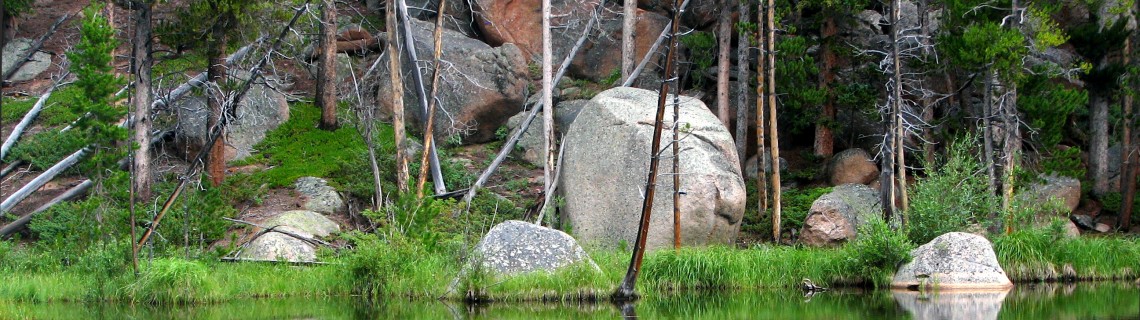
After walking through the trees you may notice some creeks from the left. This area is called “Many Ponds”. Beavers have turned these unnamed rivlets into strings of pearls. Proposed for “Research Natural Area” status in the draft Forest Service Plan, the ponds nourish a wide variety of plants and make boreal toads downright happy.
At two low pine-pole bridges there are fine spots to stop to enjoy the perfect mirrored reflections of sky, rock and trees.
The trail leads on to a second attraction, hills of amber colored, pea-sized granite gravels. Scrambling to the top of one provides searching views of Centennial and the Laramie Plains.
Beyond two more small creeks the trail turns to the west drawing you to the third attraction, overlooks of Hells Canyon, the steepest, longest plunge in the Snowies. You’ll need to step off the trail a few yards to take in the view of the forested canyon and the Snowy Range gleaming white in the distance.
Beyond “Hell” the trail joins a logging road. Turning to the left takes you to the northern trailhead.
If you are hiking from the north trailhead, walk on down the logging road. Turn right on a trail marked for snowmobiles, orange over silver. At a small logged area the snowmobile trail and the Albany Trail separate. Keep to the left edge of the clear cut.
Pointers: Since this is a relatively low elevation trail it is lovely in the spring when the upper range is still snowed under. It is also pleasant in the fall after the first snows have come to higher ground. Some big aspens may bring gold fever.

Comments
Well wisher
Sep 13, 2008
Good research and even better opinion.. How do we keep it this way?????
Roger Ludwig
Oct 1, 2008
Dear Well wisher –
Thanks for the comment. When you ask “how do we keep it this way” I gather your asking how we can keep the Albany Trail “summer, non-motorized.” The Forest Service has made a major decision to motorize it, allowing motorbikes. Before they can put their decision into effect trail improvements need to be made to protect for erosion and water clarity. This invovles a few bridges. As I understand it, the money to do so is available through license taxes on atv’s. But it will take a little time.
The only way to stop this rule change now is through the courts. One organization has taken some steps to do this but may need encouragement to continue. I talked with them a month ago. They have many other projects in the works and this one could be passed by. I’d suggest you contact them to urge them on. They are The Biodiversity Conservation Alliance and the web address is: http://www.voiceforthewild.org/
I hope you get a chance to hike all or part of the trail this fall. Let us know how it goes!
Steve
Mar 4, 2015
This trail, like so many others that hikers enjoy, was actually built by dirt bikers.
Bob
Jul 8, 2024
Illegally build by dirt bikers.